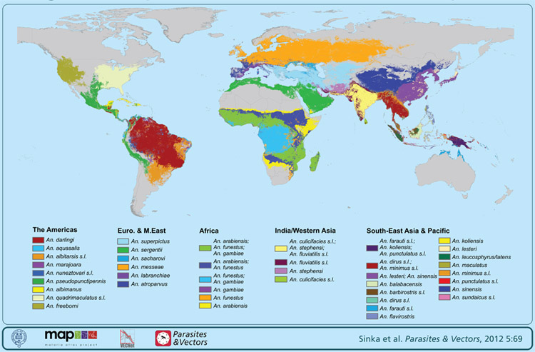
The Malaria Atlas Project (MAP) is an amazing database project put together by a diverse group of experts in order to better understand where and how malaria is affecting the general populations of the world. It is mainly funded by the Wellcome Trust, a UK based bio-medical research funding body and primarily focusses on Plasmodium falciparum, the most deadly form of malaria. Begun in 2005, MAP employs spatial medical intelligence in an attempt to better understand and, hopefully eventually, contribute towards eradicating malaria. As described on the website:
The MAP team have assembled a unique spatial database of linked information based on medical intelligence and satellite-derived climate data to constrain the limits of malaria transmission and the largest ever archive of community-based estimates of parasite prevalence.
So far they have collected data in 85 countries and the assemblage of interesting information on their pages is a seemingly endless collection of charts, animations and endimicity maps. If you are looking for malaria information on a potential travel destination, are interested in vector borne diseases, or are just a map geek, like me, you can pass quite a few hours perusing the pages.
Have malaria stories? Please get in touch as we’d love to hear them!


Leave a Reply